Im posting to see if I can try to canvas some views and glean any physical information (or other information which may inform its physical appearance) on the town of Highfolk for my campaign. Having looked at the map from LG it seems to depart from the description of Highfolk town put forth in the Gazeteer, or at least as I imagined it.
Taking a section from the LG map comprising about 1/10th of the total city acreage I counted about 500 buildings in it, not including the larger temple/government complexes. About 50% of the buildings are probably 36' sq or larger. So, if there were only 2 people living in each dwelling, that would give a population of 10,000, not including the temple populations. The official population of Highfolk is stated at approx 9000 in everything I've read.
Id assumed many medieval buildings would be multi-storied and probably have more than 1 family living in them. possibly up to 10 people per building. Based on the LG map you could probably estimate a Highfolk town population of at least 40-50,000 (= to the entire pop. Of the vale itself). Also given its status as a frontier town built predominantly of wood it purports a large amount of what would appear to be very grand public buildings.....
I would also like to ask those here more wise in GH lore than myself if they see or have read of the town of Highfolk as a river town? Nothing I have found supports (or denies) this. In fact while I can rationalise that it is positioned not far from the river its description as being situated on a spur of the foothills of the Yatils would seem to place it maybe as much as a mile or two from the Velvadyva.
My aim is to take a fresh look at the map of the town and associated environs which I have already started (and which I hope to make freely available to all who might want a copy) and as such any articles or tidbits of lore other than those provided by the Gazeteer would be a big help.
The map in Marklands shows it some distance from the river, about 10 miles or so, but for me what's reasonable is the way I would go. To not have a major trading city on a river that can support barge traffic seems kind of stupid. Why build it away from the river? As far as the town map goes, if it's the one I'm thinking of, how you treat it should depend on what you want to do with Highfolk Town. If you want it on the water make it easy on yourself, and use the contours of the map and ignore the exact building placement, or just find a map of a medieval city on a river that looks to be about the right size to you and use that. Don't feel bound by something that LG came up with. Heck, don't even feel bound by something official. I ignore the "official" map of Elredd in "Fate of Istus" and Port Elredd in "Slavers" for my campaign there because they don't really make much sense to me. It's your campaign. If you're happy and your players are happy then what else matters.
That said, there is some good info in Marklands on the political situation and demographics that could be very useful.
Most of the towns/cities on the old Darlene map are not *EXACTLY* on the rivers they are next too, though it makes complete and utterly obvious sense that these town/cities would be on the river. For whatever reason, lots of further writers chose to take the positioning of things on the map too literally, meaning that many of the towns/cities were *NOT* considered to be on a river.
This has caused untold headaches among many people.
As to the population of Highfolk, this is one area where there will be a lot more rural dwellers than there are in most other places so it probably wouldn't be a good idea to cram 10 people into each building in the town. Keep the dwellings at an average of 3 people, and set the total populace for the city itself just above that listed in the LGG. You could add a bit more if you reason that many of the rural dwellers have sought out denser population areas for protection too, as living out in the sticks where raiding humanoids might happen upon you is not such a good thing(safety in numbers and all).
Of course any population numbers will depend heavily upon what year you intend to portray Highfolk in. If it is a full decade or more after the close of the Greyhawk Wars then the population may very well be more that what is listed in any source, and that would be justifiable. _________________ - Moderator/Admin (in some areas)/Member -
The Darlene map cannot be trusted regarding the exact position of cities inside hexes. For reasons not clear to anyone, all cities were moved to the center of hexes. There are a few "official" errata, but DMs should choose their positions according to whatever makes sense for their campaigns.
Re. Highfolk, careful reading of the original boxed set seems to indicate
it is meant to be on the river or fairly close to it. Its Mayor, Loftin Greystand is indicated to be a Druid of 12th level (perhaps a half-elf). This would indicate a town with a small population density, lots of gardens and most of the buildings being one or two story houses (more like suburbia than downtown). So, 2-4 inhabitants per house is perfectly acceptable. Population in the first boxed set is indicated at 2500 humans and about 5000 demih-umans, mostly elves. Total c. 7,500.
"The Worthy Sir, Loftin Graystand, Mayor of Highfolk
Population: 2,500 (excluding demi-humans)
Demi-humans: High Elves (5,000 ) and some others
Humanoids: None
Resources: gold
Highfolk is independent and of importance simply because it is the southern outpost of the Olvenfolk of the Quagflow Valley (the Fairdells in Olven). The town itself is a trading center and home to some 2,000
humankind. It is well fortified and protects the homeland - the 100-mile stretch of valley above, which lies between the southern arm of the Yatils and the Vesve forest to the East. There are many thorps set in beautiful dales along the banks of the river, and the Lord of the High Elves dwells in the region, along with some 10,000 of his kin and numerous Sylvan Elves as well (the latter in the fringes of the Vesve on the east bank). The folk of Highfolk and the Valley above are at peace with their neighbors to the north and south. The more restless sometimes take up service with mercenary bands of Perrenlander soldiery. (...)"
I have used a pretty good Forgotten Realms supplement to flesh out a little of the Highfolk area, because a lot of adventures take place there in my campaign: The Dalelands sourcebbok (the 2nd edition version, softcover stapled publication). _________________ Lisbon Portugal<br />
Hmmmm.... if people were afraid of floods, no town would be built close to rivers. Since many are (starting with Lisbon, where I live, which is flooded on a more or less regular basis), it sort of proves that people are not afraid of floods. Not enough, at least, to build away from rivers. _________________ Lisbon Portugal<br />
Given Highfolk Town's importance, it is most likely on the river. But a compromise to keep some seclusion might be to have it on a tributary of the river. Those are too small to show on the Darlene maps but they must exist.
WARNING: LONG POST
This is a slight divergence from the specific topic of Highfolk Town, but still relavent in that it relates to the 'on the river' issue.
Up to the advent of the railroad, the cheapest way to transport anything was by river - and the bulkier or heavier the item, the cheaper river transport becomes in relation to the land-bound alteratives. This is because through most of history (the Roman Empire being the only exception I can think of off hand), roads as we know them simply didn't exist.
The Roman road network was engineered well enough that ox- and mule-drawn wagons could be used. This, however, was the exception. Thoughout history, the vast majority of road between cities (towns, villages, and etc.) were little better than dirt trails, maybe with an occasional signpost if you were lucky. Under these conditions, a wagon is simply not an option, it will likely bog down somewhere on the trail.
This brings us to the primary form of transportation available to carry large amounts of material - mule trains. On the upside, mules are strong for their size, can go virtually anywhere a human can walk, and they're generally considered too worthless to steal. That about covers their benefits. On the downside...
a) they can be stubborn, and require several 'mule-skinners' to keep a mule train going.
b) they are slow under load, unable to exceed a walking pace over any distance.
c) they are vulnerable to being attacked by wild predators - wolves, big cats, dragons, etc.
d) the reall killer, expense-wise, is that they have to be unloaded every night, and reloaded in the morning. This takes a good amount of time and effort twice daily. This is work the mule-skinners must be paid for, and the time lost makes the already slow rate of progress even worse.
On a river, however, a lot of the work is done for you. The boat is loaded once in the beginning of the trip, and unloaded once at the end. Going downstream is practically effortless, and going upstream - even with the assistance of a team of mules towing on the riverbank - went much faster than overland.
So why is this so important to the placement of cities? Ulitimately, cities are the destinations of merchants A city that is hard to get to won't see many merchants, and those that do come will charge a lot more for their goods. This means the city will not have a healthy economy, there will not be opportunites for people to make a better future for themselves, and people will tend to leave for places where they can. Okay, the serfs may be bound by law, but by and large city-dwellers aren't serfs.
In general, when I run Greyhawk campaigns, EVERY town of any size has at least a modest river running through or by it, and the larger the town, the easier it is to navigate the river. The rivers leading to the largest towns might even be dammed, dredged, and fitted with locks to make the river navigable much farther upstream than would naturally be the case. It makes simple economic sense.
And this doesn't even consider little details like getting drinking water to a city's population...
You are obviously right (although I could imagine here or there an exception). In addition, the Flanaess has an incredibly unique geographical identity, since the Nyr Dyv is connected to a system of rivers that are navigable to very far from the lake (and connect the Lake to Wooly Bay also), making it into one of the most interconnected river systems in this and many planes! It is hard to believe that towns would make themselves separate from this system that allows someone to navigate from Wintershiven in the Pale all the way to Lake Quag, above Perrenland. _________________ Lisbon Portugal<br />
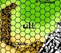
As mentioned by smillan, the Marklands map appears to place Highfolk some distance from the Velverdyva with a road leading to it. Presumably a village would be the actual port on the river, like a smaller version of Athens and Piraeus. Perhaps the Velverdyva once flowed past Highfolk and later changed course. Perhaps it is the most natural defensive position to control the valley between the Yatils and the Velverdyva. Perhaps a great knight founded Highfolk and the city grew due to his exploits. Perhaps it was the first neutral trading point between the many races of the valley.
You appear to have a map of the city, Tarquin. May I ask where you found it?
Some good points here everyone, thanks. There seems to be a general consensus of opinion as to the general feel of the town.
Mortellan I have to agree with you My own reckoning puts the town inland. I did read a brief passage which described the town as being at the end of a spur of the Yatil foothills (though I have to admit I don't remember where I read it)
Unless one were to read that the this spur pushes all the way across the valley to the Velvadyva I think it more probable that there is a tributary which flows from the Yatils to the Velva. this would leave a narrow gap/flood plain between the fortified town and the river, an eminently defensible passage through to the upper Highvale. I've also taken the view that there would of necessity be a small fishing/dock town as a stopping off point near the confluence of the two rivers.
As for the town I've drawn it as a large lozenge shaped plateau at the end of a row of hills. with one end of the plateau elevated. My own view was that it was first in use as an olven shrine/small habitation with the settlement slowly growing around it as the years passed and other humanoids moved into the valley. I've extrapolated further by adding a series of earthworks around the settlement which have been added at the time of the wars, lending it a celtic hill fort type air but with a wooden pallisade and a medieval town perched upon its flattish top.
One eye if you take a look at the Highfolk living Greyhawk site you'll find the map that I looked at but ultimately rejected for reasons of size and flavour.
Again if someone here has come across any passing references to Highfolk town in a Dragon mag or some ancient dusty, obscure tome I'd love to hear back.
Also if anyone is interested in looking at or using any of the maps and sketches that I've worked up so far let me know and I'll drop you a copy, it's free to all GH lovers.
Im posting to see if I can try to canvas some views and glean any physical information (or other information which may inform its physical appearance) on the town of Highfolk for my campaign. Having looked at the map from LG it seems to depart from the description of Highfolk town put forth in the Gazeteer, or at least as I imagined it.
Tarquin
If that's the case, why don't you just make it up to suit your own needs? If you don't know the canonical "truth", then screw canon.
Again if someone here has come across any passing references to Highfolk town in a Dragon mag or some ancient dusty, obscure tome I'd love to hear back.
I checked all the sources listed in the Encyclopedia Greyhawkia (If you don't have a copy it's
here, and it pretty much indespensable.) Most of the references weren't anything of substance except for Marklands, the LGG and the other gazetteer-type guides.
Tarquin wrote:
Also if anyone is interested in looking at or using any of the maps and sketches that I've worked up so far let me know and I'll drop you a copy, it's free to all GH lovers.
Thanks. If you feel like it how about submitting it as an article once you get it worked up? CF! can always use more content, and fresh blood in the articles department. Not that there's anything wrong with the old blood.
My players have just reached Highfolk town and I've been a little sketchy about its size and exactl lauout so far. I have rejected the LG map for the same reasons mentioned above but am loathe to make a map of my own since it's unsure how long the characters intend to stay in town. I have decided that IMC the town is a bit away from the Velverdyva river but that a minor tributary allows trade and travel. _________________ Never say blip-blip to a kuo-tua
Another unmentioned river town feature is the water wheel.
used to power mills and cranes and waterworks and pumps(archemedes screw) etc. since rome.
I like to have my gnomish and dwarvish intracate, well crafted designs contrast with the crude human contrivances but to each his own.
A large town like highfolk may have several. At least a grist mill maybe a saw mill too. Perhaps a multifunctioning gnomish creation feeding the towns sewer, fountains, running water and water clocks and aquaeducts feeding cisterns/reservoirs.
Like many other DM's I put the big towns on the river. Builds an intuitive layout for the town and gives some background devolopment you can expound on as much or as little as you like.
Other towns were by some major resource. or trading crossroads.
I finally got around to reading this tread and found it facinating. Highfolk has always facinated me, but I have never really looked into it. I should do so now, time permitting. To follow up on Muscles last comment, I can just see dams and locks running right up the tributary, with an inn at ever one surrounded by gardens and small farms. _________________ Plar of Poofy Pants
Another unmentioned river town feature is the water wheel.
used to power mills and cranes and waterworks and pumps(archemedes screw) etc. since rome.
Don't forget their use for trip hammers in a town or city that has a lot of armorers and metalworking industries. I also like the idea of the dams and locks and have just suck things laid out in the area map that I did for the Fals Gap/Thornward area.
"suck things". Well, they say here in the West that water flows up hill to money. In truth, it is sucked uphill.
It took me a while to figure out that that was a typo. I was wondering if you were saying that your map sucked. Can you post a pic or a link in this thread? _________________ Plar of Poofy Pants
Yeah sorry I noticed it after I posted and couldn't change it. I do not have a link for the map but I'll see what I can do. I'm pretty much a computer moron.
One reason to have a city not near a river is to have the city near the source of ore. THis is useful if smelting is possible near the mine. Refined ore is easier to transport than raw ore. Thus, people would gather where the work is so to speak. Even then, there would have to be a small river, lake, well, aquaduct, etc., to bring drinking water.
One would generally assume that a secondary community would be present at the site of the docks, where the cargo is loaded and unloaded for shipment.
I know that's how I end up setting things up when I play Pharoah! Heh, sorry, I couldn't resist.
Another thing to consider is that not all rivers show up on the Darlene and other maps, so Highfolk town could still be on a smaller tributary of the Velverdyva, so they could have access to the river and possibly ore sources too, like Anced_Math suggested. Best of both worlds. There would still probably be a decent town or village at the confluence.
Highfolk is connected to a river not shown on the Darlene or Dungeon maps of Greyhawk. The river is the Skuttlerun and it flows _beneath_ Highfolk, where there is an subterreanen-port. See Racing the Snake, Dungeon No. 105, pp. 17 and 37. To the west, the river/stream rises in the Yatils and flows above ground through the canyon known as Ehlonna's Scar. See id. at p. 24 and Map at p. 18. It is seasonal with springtime runoff. See id. at p. 24. Ehlonna's Scar and the connecting Scuttlerun form a trade route between Polvar in Ket and Highfolk. See id. at p. 42. There is no mention of an eastern outlet to the Velverdyva.
To this may be added the following - "Trade in the valley follows the Quagflow Road from Highfolk Town to the northern town of Verbeeg Hill, there to Perranland and beyond. Most heavy cargo is transported by barge along the river, which flows at a comfortable pace." Living Greyhawk Gazeteer at. p. 53. There is no mention of a river port on the Velverdyva but something of the sort can be reasonably inferred from the above quote concerning heavy cargo. The Marklands map, reproduced upthread, shows Highfolk some distance to the river.
If one so desires, the unnamed river that flows through Luzern Valley and the Tronewald Forest, "a domain bordering the Yatil Mountains and the Vesve Forest," could pass by Highfolk before emptying into the Velverdyva. See generally, Totentanz, Dungeon No. 90 at p. 35 and map at p. 38. Along similar lines, the trail between the town of Luzern and the village of Thun could be the Quagflow Road from above.
Taken together, then, Racing the Snake and Totentanz can help put Highfolk in a greater context. This is what I have done in my campaign. See The Timberland Festival
http://www.canonfire.com/cf/modules.php?name=News&file=article&sid=672
While there is no specific reference in the article to a river port, there is mention of "log rolling." It was and is my thought that Highfolk is connected to the Velverdyva sufficient to see timber sent downstream to Furyondy. YMMV. _________________ GVD
You cannot post new topics in this forum You cannot reply to topics in this forum You cannot edit your posts in this forum You cannot delete your posts in this forum You cannot vote in polls in this forum
Canonfire! is a production of the Thursday Group in assocation with GREYtalk and Canonfire! Enterprises